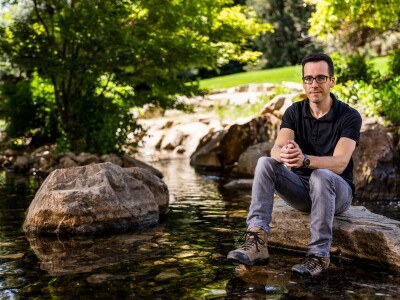
Professor Jim Nelson has 30 years of experience modeling watersheds

Civil engineering professor Jim Nelson is a hydrologist with decades of experience. He’s traveled across the country and the globe to consult with federal agencies, nonprofits and engineering consortiums to help better predict streamflows and plan for either drought or flooding. But for the first time in his 30-year career, with the potential for flooding across Utah this spring, he’s putting his knowledge to work right in his own backyard.
“I joke that my neighbors finally care about what I do,” Nelson said. Nelson has been providing a wealth of information for those in his Springville neighborhood and sees that as the key to preparation for whatever flooding may or may not occur. As one of BYU’s foremost flood experts, Nelson shared his knowledge and tips here for those throughout Utah with flooding concerns.
Q: How do I know if my home may be affected by a flood? What should I be looking at to gauge whether to be concerned?
A: The first place to look is the FEMA flood maps that are available online. Most people who buy a home in a FEMA-designated flood zone are aware because they are often required to have flood insurance. That being said, just because you’re not in a FEMA floodplain or flood zone, it doesn’t mean you’re not at risk. Flood maps are based on ideal scenarios, with the assumption that the stream channel and road crossings will convey water as expected. Floods often occur where there is a weakness or where debris gathers, which can’t always be anticipated.
Obviously, proximity to a river is something to take note of; most of the trouble will come by water that escapes the river channel. If you live in a low-lying area in your neighborhood, you should be aware. If you see a storm drain near your home, that probably means you live in a lower-lying area of your neighborhood, and water is likely going to come towards that storm drain.
Q: What would you tell people who are worried about flooding?
A: This is where I think good information is helpful. Sometimes that information can be a little bit alarming, but nevertheless, having that information is only going to help you make the best choice for your peace of mind. Everybody has different experiences: if you have experienced flooding before, you’re definitely going to take more precautions this spring. If that’s you, and you are concerned, then go ahead and do it; it never hurts to be overly prepared. You might have neighbors around you wondering, “What are you thinking?” But if it helps you feel more comfortable, more at peace, then do it. People also ask me if they should get flood insurance. If it gives you peace of mind and you can afford it and you are in an area with some potential flood risk, then you may want to do that. And hopefully you won’t have to use it. (Note: Flood insurance sometimes takes up to a month to be activated, so it might be too late for this year.)
Q: What can I do to prepare now in case my home/neighborhood does get flooded?
A: One of the things the Utah floods from the early 1980s taught us was that in addition to the late April/early May snow and the subsequent quick warm up, debris causes a lot of the problems. It’s good to clear debris in and around streams and waterways near your neighborhood and home. (Note: Most rivers are probably flowing fast enough by now that going in to clear debris is too dangerous, so hopefully that has already been done.) Another step would be to have some sandbags available. Be sure to talk to your neighbors and coordinate your flood mitigation efforts; don’t take the ‘every person, every home for themselves’ approach.
Q: How does this year compare to 1983?
A: The main similarity between 2023 and 1983, when we last experienced widespread flooding in Utah, is that the snowpack is large like it was back then. How the weather plays out will determine how similar or different the flooding becomes. In 1983, Utah had heavy snowpack still in late April and early May, and then it warmed up quickly over the course of a few days, and I believe there was some rain. While we don’t know for sure what will happen, it appears from current forecasts that we are on track to have a more favorable weather pattern than that. Does that mean there won’t be any flooding? Not necessarily. The cool spell last week stalled the melting a bit, so we still have a ways to go, and it varies by location.
Q: What changes were made after 1983 to better prepare for floods?
A: We know that debris caused blockages that forced the water out of the channels and into the streets, turning them into rivers. We are in a much better position today than we were in the 1980s to manage that. This time around, people have been clearing out debris along rivers. There are also debris basins and control that didn’t exist in 1983 for many locations, so that is a major change that should significantly mitigate current potential for flooding. Also, our water management ability, knowledge and actual storage capacity has improved since the 1980s. For example, people who live along the Provo River are probably a bit anxious right now because it is flowing so high. But that high flow is a purposeful management decision: releasing more water from Deer Creek Reservoir will ultimately provide more room for spring runoff in the reservoir when snowmelt is higher.
Two other things working in our favor are experience and data. We have the 1980s in mind: we saw that happen, and we don’t want that to happen again. Back then they probably didn’t know what could happen; they didn’t have that experience. And we have so much more information and other water management data available today to help us make critical decisions and be warned of extremes.
Q: When should we expect the peak spring runoff to happen?
A: The window for peak runoff is generally May. That said, the larger the river basin, the later that peak runoff will be because it needs to bring down snow higher and farther away. For example, the peak runoff for Hobble Creek in Springville is usually done by the first week of May, but it will certainly take longer this year. The Spanish Fork River is a much larger drainage from a much higher area, and it will likely peak a few weeks after Hobble Creek, running into June. Rock Canyon in Provo will experience peak runoff much sooner than, say, the Provo River drainage system. To get a better sense of peak runoff dates for waterways in and around your neighborhood, check out the Colorado Basin River Forecast Center site. It has a lot of very helpful data, and you can search by specific stream or river names.
Q: What are the long-term effects of flooding on the environment/community?
A: I’d say one of the impacts of flooding is that weaknesses are exposed in residential development. So far what we have seen has mostly been in areas that were already developed at the limit of where homes can safely be built. Flooding also brings light to construction practice that wasn’t as good as it might have been. Of course, no home is constructed to be 100 percent sure to withstand the impacts of nature, but when it happens to you, it’s devastating. A lot of the people I know live right along a creek or river, and they’re cognizant of potential flooding and try to manage the risk. While it’s traumatic for those who experience significant loss to natural disasters, from an engineering point of view, it often leads to better design and helps societies be better prepared for future floods. For example, there was massive, widespread flooding in Germany last year in areas where they thought they were prepared. But they weren’t, and now they’re making significant changes to improve so that it doesn’t happen again.
Q: In this time of potential flooding, what is your big takeaway for residents?
A: I think it’s a great reminder that we live with risk and uncertainty every day of our lives. Right now, that uncertainty is heightened because of flooding concerns that are on our minds. I always joke that the first class every child should take in kindergarten is a lesson on probability. We have to recognize we live with uncertainty and be okay to a certain degree with that uncertainty. But as we grapple with uncertainty, we also need to fortify the areas where we have the greatest possibility of risk. The COVID pandemic prompted people to become very much aware of how much risk there was and how much they were willing to take on. As with the pandemic and as with potential natural disasters like flooding, good information is the antidote to fear and worry, and it helps us make the best decision we can with the resources we have.